

Background Information
Location of MSU and its water supply wells
The MSU campus is located in northwest Ingham County, Michigan. The campus occupies approximately 8.19 square miles and is within the Red Cedar River drainage basin. MSU has 18 Type I water supply wells located on campus. All but one of the supply wells are located on the South Campus (south of Mt. Hope Road).
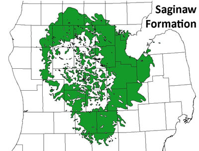
Most of the Mid-Michigan area gets its drinking water supply from the Saginaw Formation. The Saginaw Formation is an important aquifer that in general has a very high water quality. It consists of mostly sandstone with interbedded shale, limestone, coal and gypsum. In most places it is 100 - 200 feet thick.
Description of Supply/Distribution System
MSU's Infrastructure Planning and Facilities (IPF) provides water ultilities to campus facilities. MSU is a groundwater-based public water supplier, and the campus relies entirely on groundwater for its water supply needs. Wells are completed at depths ranging from 285 to 435 feet. MSU pumps approximately 4.0 million gallons per day on an average day and has a maximum capacity of approximately 6.6 million gallons per day. The water is delivered directly to facilities south of Mt. Hope Road or to a central reservoir, where the water is treated before being pumped to buildings north of Mt. Hope Road. Before delivery to the Main Campus, the water is treated with fluoride, chlorine, and phosphate. The water is then provided to the approximately 50,000 customers, approximately 17,500 of whom live on campus.
MSU monitors the quality of its water supply for a variety of potential contaminants in accordance with state and federal regulations. IPF prepares an annual Water Quality Report that provides key information about the quality of MSU's water supply.
Wellhead Protection Activities
In 1993, MSU began its wellhead protection process by participating in a cooperative effort to delineate Wellhead Protection Areas (WHPAs) in the Tri-County area (Ingham, Clinton, and Eaton Counties). The Tri-County area delineations were performed by the U.S. Geological Survey (USGS) in 1996. The MSU WHPA delineations were initially approved by the State of Michigan in 1999. Several updates to the delineations were completed to reflect the changing status of the water supply wells. The most recent delineation was completed and approved by the Michigan Department of Environmental Quality in 2014.
Other Campus Environmental Protection Programs
The MSU Wellhead Protection Program reflects MSU's commitment to protect groundwater resources, and it is one of several ongoing efforts to protect the MSU campus and surrounding environment. For more information about these efforts, please visit:
http://ipf.msu.edu/green/water/index.html
MSU's Wellhead Protection Plan - Click on the link below to read about each of the seven state mandated elements.